Saturday, January 26, 2013

Bike Trip Overview


After 29 days of travelling and 2101 kilometers of pedaling, the bike adventure has finally reached its conclusion.

Since starting, this trip has helped the secondary school of Logozohe gain $995 in direct donations and an additional $1,640 have been pledged.  Taking into account all of the money theoretically placed towards Logozohe’s future computer lab, $2,635 of the $3,850 needed has been raised – nearly 70%! This is outstanding!

Crossing the finish line was a great feeling, and part of the team I started the trip with came back to Natitingou to help me celebrate.  We were met by a newspaper reporter, asked to do a radio interview, and even given free pizza at Chez Guillaume (really tasty!).  All-in-all, a good end to a great adventure.

There probably won’t be any more major posts put online, but I will leave this site up for anyone interested in learning more about Benin or reading about my experience in this country.  Feel free to contact me if you have any questions at crawford.david.dmc@gmail.com.

Kandi to Natitingou - Crossing the Finish Line


January 20 – 25

Day #24Started: Kandi                             Ended: Banikoara                          Distance Covered: 68 km
Day #25 – Started: Banikoara                      Ended: Brignimaro                         Distance Covered: 77 km
Day #26 – Started: Brignimaro                    Ended: Gnemasson                       Distance Covered: 40 km
Day #27 – Started: Gnemasson                  Ended: Kouande                            Distance Covered: 47 km
Day #28 – Started: Kouande                       Ended: Ganikperou                        Distance Covered: 12 km
Day #29 – Started: Ganikperou                   Ended: Natitingou                           Distance Covered: 43 km


Highlights
  • Mud brickyards
  • Sacred waterfall
  • Visiting other volunteers' projects
  • Crossing the finish line

Click on the images below to enlarge

A brickyard full of bricks made
from mud, straw, and water.  One
brick sells for $0.04.
My bike didn't have too many
problems along the way, but
2 days from finishing this
happened.  About 15 seconds later
the inner tube you see exploded.
Women weaving textiles. This
style of fabric is one of the
fancier kinds available


I thought this was a field filled
with strange rocks at furst, but
these are actually old, eroded
termite mounds.  This used to
be a forest, and these mounds
used to be much bigger and
pushed up against large trees.
A sacred waterfall near
Ganikperou.  Swimming is
allowed here only one day out of
the year, following an important
ceremony and an animal sacrifice.
A group of guys in their cabbage
garden.  They were really friendly,
and even gave me a free cabbage!


Finished!!  Over the past six days I’ve made my way from Kandi back to Natitingou, where this whole trip started 29 days ago.  The last leg of the journey consisted of a series of smaller distances, as there were a lot of volunteers’ villages that I was passing along the way, and I couldn’t pass up opportunities to visit friends I hadn’t seen in a long time.

The landscape of this region was similar to what I’ve been seeing while travelling through much of the north.  I passed several herds of cattle being led by Fulani people, fields filled with cotton and millet and shea trees, and loads of dust swirling in the air.  Lots and lots of dust everywhere.

The shorter days of biking were probably a good thing for me, actually, as I caught some malady and found myself getting a lot more tired from biking than normal.  Due to how arid it is at this time of year, loads of dust can inevitably find its way into your lungs (especially if you’re travelling on roads frequented by cars and semis), and this can cause a number of unpleasant ailments.

Stopping at so many different volunteers’ villages made biking more manageable, and it also gave me the chance to see what my friends have been working on.  Every volunteer’s living and work situation are very different;  Some of the people I visited were among the wave of volunteers that arrived in their village this past September and have just finished settling in to their new homes, and some have been in town as long as 16 months.  Some were put into a more rigid work schedule – as a teacher with assigned class times, for example – and others have had hardly any guidance and rely entirely on their own initiative to seek out and start projects.  Some were placed in towns and cities where a high level of French is spoken at a quick pace; others are in tiny villages where the vast majority speaks a specific local language that necessity requires them to learn.

One of my friends - another Peace Corps Volunteer -
making garden beds with a gardening group he's
been working with for the past year.
Regardless of the environments these volunteers were placed in, it’s been great to see how each individual has confronted their challenges and made things work.  I visited volunteers that were serving as extension agents to gardening groups throughout their region; that were teaching high school students entrepreneurial skills and helping them start their own business; and that were getting their hands dirty in the fields to convert unused brush-land to an irrigated, community garden that may be prosperous year-round.  It’s been great to see the hard work my friends have been putting into their communities, and to appreciate them for it too – far too often volunteers don’t actually realize how remarkable their actions actually are.

It’s also made me realize that I’ve got to get back to work soon too.

This trip has been amazing; I feel like I’ve seen and understand far more of Benin than I did one month prior.  I’ve had many cultural experiences that I won’t forget, and I’ve gotten to share them with some great friends.  I’ve also been amazed time and time again by the generosity and hospitality of the Beninese people that have helped me along the way during this trip – whether it be by giving the group a small gift for passing by, putting us up somewhere to pass the night, or helping retrieve a camera that appeared to be lost forever.  Hopefully this blog has done some justice to a country that is not too often travelled or publicized, yet is filled with history, culture, and some really great people.

This roundabout marks the entrance to Natitingou - finally made it full circle!
Now it’s time for me to go back to the lovely village of Miniki and return a community that’s been calling me a lot lately, asking, “Did you go home or something?  When are you coming back, anyways?!”


Sunday, January 20, 2013

The Northern Stretch - Malanville and Back


January 17 – 19  

Day #21Started: Kandi                              Ended: Malanville                             Distance Covered: 102 km
Day #22 – Started: Malanville                        Ended: Kassa                                  Distance Covered: 55 km
Day #23 – Started: Kassa                             Ended: Kandi                                   Distance Covered: 97 km

Highlights
  • Wildlife reserve
  • Benin/Niger border
  • Gardens; veggies galore!
  • Camels, donkeys, oxen
Click on the images below to enlarge
Throughout the north, there are 
butcher shops in most sizeable
towns.  More people raise, sell,
and eat animals in these regions.
Here's a bit of a change from the
ordinary Deer X-ing signs we're
used to seeing.  Near the wildlife
reserves there are elephant
crossing signs!
The entrance to the Benin/Niger
bridge.  The two countries are
split by the Niger river

One of the last things I expected to
run into during this stretch of the
trip was a camel.  Turns out
they're are loads of them not too
far from here, just across the
border in Niger.

Rounding up onion cuttings from
the fields.  Large scale gardens
line this area near the Niger river

Most of the villages that I passed
on the return trip to Kandi looked
extremely basic.


The last three days have been among the most adventurous of this entire trek for me.  They’ve landed me in some interesting and unexpected places (also why there have been no posts for the past 5 days – see below for another new one as well), and I’ve got a handful of stories from them.

I saw scores of beautiful birds flocking to watering holes in the nature reserves near Alfa Kouara, an array of animals I don’t usually encounter in the south (lots of donkeys pulling carts, some of the biggest cattle I’ve ever seen, and even a camel), and expansive fields of garden produce alongside the Niger river.

I’m sure I could write loads about my night befriending one of the military superiors stationed at the Benin/Niger border, about getting way-sided in a tiny village at nightfall and being put up by the village chief, about losing a camera and eventually having it find its way back to me from Nigeria, and about finding my way back to the main highway with a compass and a list of village names and river crossings I was told to follow to get back home.

But to stray on the cautious side of being a bit too verbose, I’ll try and let the pictures show the highlights of the journey – enjoy!

A roadside brush fire.  Sometimes these
are started by hunters trying to scare
animals out into the open. Other times
they are simply started due to the intense
heat setting dry grasses ablaze.
A nature viewing area at one of the nature reserve
park entrances in Alfa Kouara
Construction for a new water tower outside of Malanville.
Workers said the tower should be completed in 5 months.
Oncoming cattle barrelling down the road.  You've got
to make sure not to spook these guys when you pass
through them.
If it weren't for these women, I would have been lost.
For not speaking the same language, it's pretty amazing
that they were able to point me in the right direction
and tell me I needed to cross the river.  They got a kick
out of me hoisting my bike up and  wading across.


The final leg of this bike trip is finally here, and starting today I am heading from Kandi back to the starting point in Natitingou.  If all goes well, in about four or five more days the trip will be complete, and it'll be time to celebrate!

Lost!


January 15 – 16

Day #19Started: Peonga                           Ended: Gogounou                           Distance Covered: 89 km
Day #20 – Started: Gogounou                       Ended: Kandi                                  Distance Covered: 35 km

Highlights
  • Solar panel gardens
  • (Almost) Hopelessly lost
  • Baboons

Click on the images below to enlarge
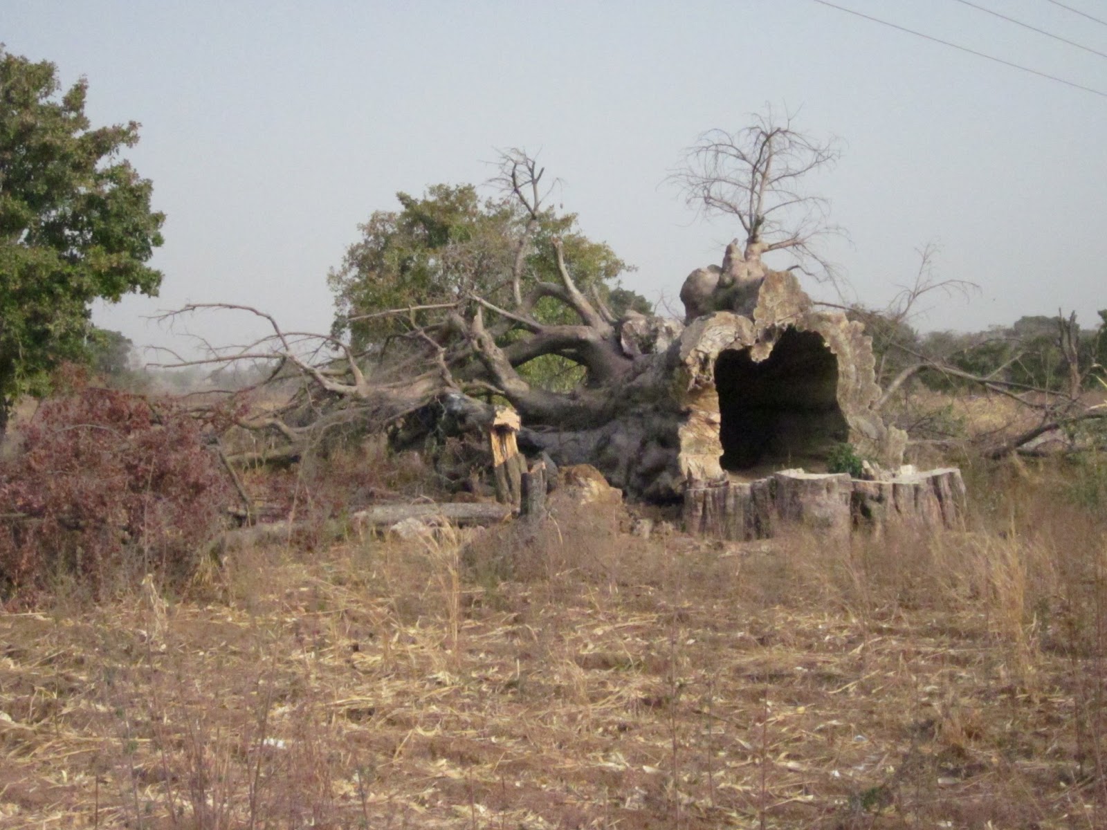
A huge baobab tree that was
felled.
I had no idea these
trees were 
hollow!
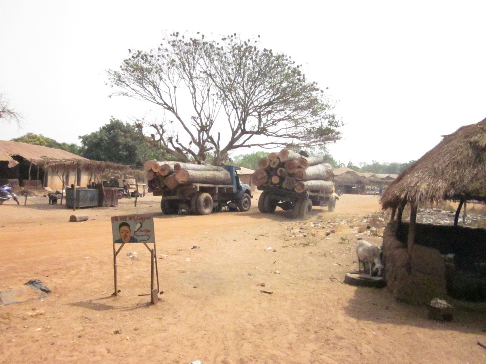
Part of a remote village I assed
on the way into the forest.  The
structures on the left are used
to keep millet out of the reach
of animals
Solar-powered drip irrigation
gardens in Dunkassa


Up until the last two days, navigating through the back roads of Benin had gone almost uncharacteristically well; I had yet to truly get lost, and there was always someone nearby to ask when confusing splits in the road did occur.  Perhaps as you can tell from a bit of foreshadowing – this was not the case for this leg of the trip!

The up-and-coming  Peonga SELF garden installation. 
Day #19 started just fine.   Before really setting off, I got to tour a plot of community gardens that are currently under construction in Peonga.  With the help of The Solar Electric Light Fund (SELF), an American non-profit organization, these gardens are in the process of installing a drip irrigation system powered by solar energy.  Following this, I passed by the village of Dunkassa, where a nearly identical drip irrigation system was installed by SELF three years ago.


The current SELF garden installation in Dunkassa.
It was really cool to see these systems; they take advantage of a form of irrigation that is very mindful of water conservation, while at the same time using a renewable resource to run the whole operation (the sun).  And not only do these projects increase villages’ access to food security – as they help them gain independence from solely rain-fed agriculture – but they also bring a lot of economic development to the area as well (leading to extra money to pay school fees, medical fees, and additional income-generating activities).


Plus, a good friend of mine was posted as a Peace Corps Volunteer in Dunkassa less than a year ago, and the gardeners in Dunkassa absolutely loved her – which resulted in some free carrots as I passed by!

Shortly after leaving Dunkassa is where things started getting confusing.  I decided that I would pass through the Three Rivers Forest, which covers a large swath of land just to the east of the highway and on towards Nigeria.  The section I needed to cross, south-to-north, was about 45 kilometers across.  Now, on the map there really isn’t anything marked within the forest, but there is a small dotted line that indicates a trail crossing through it exists.

Which to me meant – no problem… I’ll just ask people along the way and figure it out.  Only problem was, there really weren’t people along the way!

After getting about 5 kilometers into the forest, I stopped seeing signs of villages or even fields.  Eventually I got to a point where the path I was on diverged into two trails that looked equally travelled.  I decided to pick the one that had two tire treads – since I figured it’d be smart to take the trail that cars occasionally passed on.

Wrong! After about 90 minutes, two busted tires, and several hesitant glances at tree shadows thinking, “I really shouldn’t be going east right now…” I decided I had to turn back.  I was deep into the forest, and I hadn’t seen anyone in a long, long time.  In retrospect, I think I had been taking a trail forged by logging trucks – which does not necessarily lead to anything.  At this point I was pretty frustrated with myself; I was hot, hadn’t much water left, no idea where I was, and had to back-track big time.

Ok, fine - I know this could pass for one of those bigfoot sighting photos, but I promise you that the black
blurb in the background is a baboon.
Just then, two big objects barreled out of one side of the woods and crossed right in front of my path!  They got to the tree line on my right side, stopped, and started hooting angrily at me.  It was a pair of baboons! Big baboons at that, and they weren’t leaving.  I definitely got the feeling that I was in their territory, and they wanted me out.

Despite my desire to descend from my bike and take National Geographic worthy snapshots of them, I decided against it and headed back to the fork in the road where I should have taken the other path.  Coincidentally enough, I rode back pretty quickly… (I was never sure if the baboons followed me, or if their howls just carry exceptionally well, but I heard them for quite awhile after taking off).

Once I got back on the other side of that fork, things went well for the rest of the way, relatively speaking.  It still took another hour to run into someone and I put a hole in another tire, but 30 kilometers later and I made it through to the village of Zougou Pantrossi.  The look on people’s faces as I came out of the trail leading to the forest was priceless.

The best part was when I answered someone who asked which route I’d taken and he looked at me like I was crazy and said, “People here don’t even do that!”

In-case the earlier picture of the baobab didn't emphasize how big these trees truly get. I'm a little taller than 6', and here I am standing comfortably inside of the trunk - no camera tricks here.

Thursday, January 17, 2013

Cotton and the Gando

January 13 – 14

Day #17Started: Parakou                         Ended: Nikki                                       Distance Covered: 103 km
Day #18 – Started: Nikki                               Ended: Peonga                                  Distance Covered: 66 km

Highlights
  • Cotton processing factory
  • Entering Bariba territory
  • Gando villages
Click on the images below to enlarge
Much of the land north of
Parakou and used for grazing.
These kids followed their brothers
to the fields to help watch after
their cattle.
The majority of houses in villages
throughout Benin are constructed
in this manner with mud.  The
larger stones are used to
reinforce the walls.
Semis are loaded to the brim with
cotton this time of year.


Since leaving Parakou, I’ve began to head north through the Borgou and Alibori Departments of Benin.  I’m now travelling alone, and although the past two days of biking have been a bit lonesome, I’ve noticed that I’ve become a lot more approachable to others.  When biking as a group, our team had plenty of interactions with people in villages and towns we passed by, but now it seems like there’s absolutely no hesitation for people to come over and ask me what I’m up to.  This has helped me to have some great conversations and see some interesting things along the way.

For instance, shortly after leaving the city of Parakou, I passed by a large factory that had a long line of semis filled to the brim with cotton.  I got off my bike and asked one of the drivers if he would mind me taking a photo of his truck.  Not only did he accept, but he asked me if I wanted to take a whole tour of the cotton processing plant – which didn’t even seem like an option to me, as the premises were walled in and watched by a group of guards; it definitely looked like a private enterprise in which tours were not often conducted.

Turns out it was a private enterprise in which tours are not often conducted.  But nonetheless, this driver introduced me to one of the plant administrators, and after I explained a bit of the bike trip to him he promptly escorted me through the whole plant.

I wasn't allowed to take pictures within the plant,
but my guide turned out to be the head of the shipping
yard - so he actually encouraged me to take this one. 
Each of those bags contains 500 lbs of cotton fibers!
The tour was really interesting – within the plant there are a series of tubes in which cotton is sucked through the plant (like those tubes at the drive-in lanes at the bank) and then passed through machines which remove the seeds from the cotton fibers.  The cotton and seeds are both packaged into separate sacks, and sent to industries that will transform them.  The cotton is sold to companies both within and without of Benin, and the cotton seeds are sent to Beninese vegetable oil processing plants in Bohicon. Apparently many western countries prefer buying cotton coming from countries in which it is picked by hand – such as Benin – as it often contains fewer impurities than cotton picked by machines.


This sign reads, "Gandia. Place of
justice before colonization.
Kassakperegui - the surpreme
judge".  Apparently this is where
the Bariba king of Perere used to
behead criminals.  It's a pretty grim
idea, but the place just looked like
a overgrown field to me now.
After leaving the cotton plant, I started encountering more and more people that spoke languages I had hardly ever heard before: Bariba and Fulani.  Both of these ethnicities are very prominent in the north-eastern regions of Benin, and both traditionally consist of cattle herders.  The main difference between the two, though, is that the Bariba are essentially sedentary, whereas the Fulani are semi-nomadic.  Nowadays this causes some interesting social/political disputes as land claims have become more official, and sometimes rifts happen between the two ethnicities.

During one of my nights in route, I got the chance to stay in a village with a very interesting combination of both of these two groups; a Gando village.  I knew close to nothing about this ethnicity before arriving, but the volunteer I stayed with did a great job of explaining a part of its history to me.  Traditionally, the Fulani are on one of the lowest rungs of the social cast system in this area of Benin, and the Bariba appear to be on a much higher one.  In general, the Bariba and Fulani would not mix, but occasionally a Bariba family would give birth to a child that had certain characteristics deemed unlucky (I believe one of which was two teeth pointing in different directions), and the parents would either kill the child or give it to the Fulani.  The Fulani would then raise the child, and he would work alongside them.  Once he became old enough, his biological family would sometimes give him land as a way of still caring for him.  Due to these circumstances, the child would not truly belong to either ethnicity, though he would interact with both.  Eventually, this happened enough to make entire neighborhoods of these neither-Fulani-nor-Bariba individuals, and with time they became the Gando.

This history is just a small example of one of the many different groups within Benin. Even though the country is pretty small (roughly the size of Pennsylvania), the variety of different ethnicities and languages is quite enormous.


Sunday, January 13, 2013

Breaking Up the Band

January 11 - 12

Day #15Started: Save                               Ended: Ouesse                                 Distance Covered: 56 km
Day #16 – Started: Ouesse                          Ended: Parakou                                 Distance Covered: 107 km

Highlights
  • More inselbergs (mini-mountains)
  • Charcoal production
  • Bike team parts ways

Click on the images below to enlarge

Coming back north, we started
seeing more of the mini-mountains
this 
area is famous for.  Turns

out the 
technical term for the

g
eological 
formations are
"inselbergs" 

Cassava drying along the
highway.  Many people
use the flat, exposed
shoulder of the road to
dry their produce
Monuments greeting incoming
travelers coming to Parakou


Travelling north of Save took us through the very center of Benin, which is surprisingly open and fairly uninhabited.  The two major highways in the country that run north-to-south diverge in Dassa (just south of where we started), and the space between the two of them has pretty much been left alone.

This isn’t to say that there is no activity in the area; we saw plenty of make-shift quarries, fields, and woodlots; but not a ton of people.  In fact, about 20 kilometers north of Save, the land started to look pretty desolate.  It may just be the time of the year, but the land was extremely dry and windswept.  It’s very different from the western side of the Collines Department where I live, which seems to be filled with far more trees.

Charcoal
Even though the difference in the landscape could just be chalked up to natural environmental conditions (such as a different soil type), it’s a bit concerning to see such a difference in the number of trees in the area.  It seemed like constant brush fires combined with massive amounts of charcoal production (which involves felling trees and then smoldering them into coals) might be providing the perfect ingredients for a recipe of desertification and degradation of the land.  This could just be the concerned environmentalist in me talking, though.


After visiting some fellow volunteers in this region (who turn out to be outstanding chefs!), our team deviated from the back-roads and rejoined the main highway on our way to the city of Parakou.  Unfortunately, this was the last stretch of the journey that all four members of our crew could be together for.  The three girls that I have been travelling with had to return to their respective villages today, so that they could continue their work saving babies, filling gardens with loads of bountiful produce, and turning artisans into business gurus.  The past two weeks have been so amazing because of them, and it’s certainly not going to be the same continuing on alone.

The team!

Don’t worry, the trip isn’t over.  I’m going to keep pushing on and continue heading north.  Over the next few days I will be making my way up to the city of Kandi, and then eventually to the Niger border and the town of Malanville.  More to come soon!


·

Saturday, January 12, 2013

Over the South and Through the Woods

January 9 - 10

Day #13Started : Houeda                         Ended: Kpankou                               Distance Covered: 105 km
Day #14 – Started : Kpankou                       Ended: Save                                     Distance Covered: 95 km

Highlights
  • Industrial areas
  • Oro
  • Fulani cattle herders
  • Forests, logging, and fires
  • Pepsi!

Click on the images below to enlarge

Fulani cattle herders are semi-
nomadic people who travel
through much of West Africa by
foot with their cows.
Bikes sitting outside a secondary
school on the way to Sakete.
Seems like the kids here know
the best way 
to travel!
A cement processing plant just
outside of Ketou


The past two days have been exhausting, but our team finally completed a 200 kilometer stretch from the south to the city of Save in the Collines Department.  We had to brave a long length of busy highway and make our way through an expansive and fairly uncharted forest, but now we’re finally back in regions where the weather is cool and laundry can actually dry overnight (humidity has dropped so much!).

An electrical power sub-station outside of Sakete.
This station helps power traverse several
southern countries in West Africa.
In traveling between the cities of Sakete and Ketou, we passed a lot of industrial establishments.  Although it was difficult to discern what many of them were, it was clear that they had large machinery inside due to the huge power grids found outside.  It’s both surprising and encouraging to see such large-scale enterprises in Benin; it’s not something that I’ve seen much of while travelling during my 21 months in Benin, but it shows that there is substantial economic growth happening somewhere.

Upon reaching Ketou, we weren’t sure exactly what to expect.  Ketou is the center of a region where voodoo has a powerful influence, and the day following our arrival was the national day of voodoo celebrations.  This would normally seem like the combination for some interesting encounters, but it actually turned out to be a cause for a bit of concern for
our group. 

On our way to Ketou, we spotted this house; it has a
cross surrounded with the white flags that symbolize
voodoo.  In Benin, voodoo is very compatible with
other religions.
Near Ketou, a deity known as “Oro” is well respected and even worshipped by part of the community.  During certain periods of the year, Oro is known to appear in this region and roam the land accompanied by those initiated into the divinity.  Depending on who you ask, you may hear that the Oro roaming the land is actually the deity himself, or someone serving as a vessel for the deity.  This may sound like something interesting to see, but it is actually forbidden to the eyes of those not initiated into the divinity.  It’s said that if a woman sees Oro, she will be killed by him and his followers; and if an uninitiated man sees him, he must either become initiated or suffer the same fate.


This all seems like an extremely dangerous situation, but fortunately those performing the ceremonies do their best to ensure that no one uninitiated stumbles across Oro by accident.  Towns and villages are notified days before he plans to come out, and they essentially become ghost towns for the week (as most people in the community board themselves off in their houses).  Once Oro does arrive, those accompanying him leave signs and make as much noise as possible to ward others off when he is roaming about.  Nonetheless, I still hear that a few people are killed due to Oro each year, so it’s not something to be taken too lightly.

We were a bit worried that we might have to watch out for an Oro appearance near Ketou, especially because we were passing by one of the sacred forests known to be a place of ceremonies devoted to him.  But luckily, we learned that Oro is very respectful of holidays and an outing was not planned for the period we were there (if he came out, everyone else would stay in and be unable to celebrate the national day for voodoo).

Many of the villages we found in the forest
were extremely isolated and basic.
Once past Ketou we took back roads through fields and forests that lead from the border of Nigeria to our final destination of Save.  This area is apparently one of the most dangerous in Benin, as bandits use the roads to make robberies and traffic goods.  Fortunately we didn’t run into any of these, though we did have some annoying problems with Beninese gendarmes at roadblocks that wanted to reprimand us for not notifying them that we were biking on their roads (essentially a power struggle with a military officer that wanted to feel important – completely ridiculous!).


Seeing as how we were on an adventure through a “dangerous” forest on little-explored roads, this just prompted a couple of epic monologues about our metaphorical journey through Mirkwood Forest, though I’m not sure the rest of the bike team found them quite as amusing as myself (who isn’t a fan of The Hobbit though?).

Logging trucks transporting tree
cores out of the forests.
In reality, the land that we biked through did not seem too often travelled, though it was quite beautiful.  Many of the villages we passed were among the most rural and isolated that I’ve seen in Benin, and many of the passerby’s we encountered on the road were not locals, but the semi-nomadic Fulani people who move cattle throughout much of West Africa.  We saw a lot of forests packed with trees too, but it was clear that they are being put to the test.  Signs of constant field fires show that young trees face a challenge to reach maturity, and logging activities are also taking their toll on larger, older trees found nearby. 


It took a while to make it through the forest, since the distance through them was long and the roads were not always the best.  But in the end it was all worth it, because we found a village that was hidden beside a river that sold one thing none of us had ever came across in Benin – Pepsi!

Coca-Cola is all over Benin,
but Pepsi is a rare find.